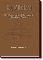
Lay
of the Land: The History of
Land Surveying in San Diego County |
|
 The
Lay of the Land is a must for Professional
Land Surveyors, Civil Engineers, Title Officers,
Land Planners, Land Use Attorneys and anyone
interested in the development of San Diego
County. The
Lay of the Land is a must for Professional
Land Surveyors, Civil Engineers, Title Officers,
Land Planners, Land Use Attorneys and anyone
interested in the development of San Diego
County.
Click
the cover icon to view larger images.
|
|
About
the Book
The Lay of the Land presents an
informative history about the development of San Diego.
The story begins with the liberation of Texas and continues
with the subsequent war with Mexico. Mr. Pallamary’s
book follows General Stephen Kearny and his corps of
surveyors as they mapped and marched their way westward
to California. The controversial actions of The Great
Pathfinder, John Charles Frémont are also covered,
as are early encounters between military Surveyors and
Native Americans. The book also covers the challenges
involved with locating the International Boundary Line
between the United States and Mexico as specified by
the Treaty of Guadalupe Hidalgo. Mr. Pallamary also
provides informative insight into the creation of the
government townships and section lines that govern the
location of land throughout Southern California. Additional
subjects contained in this informative manuscript include
the impact of the land squatter movement on San Diego,
the influence of the contentious No-Fence Law upon land
settlement, the establishment of the San Bernardino
Baseline and Meridian, and determination of the county
boundary lines.
The Lay of the Land also examines
the confusing land grant process and the obstacles involved
with validating these claims before the United States
Land Commission. Another important subject covered by
Mr. Pallamary is the expansion of the transcontinental
railroad and its impact upon San Diego. A number of
the county’s most important engineering projects
are also explored, including the relocation of the San
Diego River, the transformation of False Bay into Mission
Bay and the development of San Diego Harbor. Considerable
coverage is provided on the subjects of land fraud,
water boundaries, corrupt government Surveyors, and
the Great Land Boom of 1887. Mr. Pallamary also documents
the influence of many of the county’s more influential
Land Surveyors including George Derby, Andrew Gray,
Colonel John Coffee Hays, Cave Couts, Charles Poole,
James Pascoe, Charles J. Fox, Myron G. Wheeler, Edwin
Capps, Andrew Ervast, and Porter Perrin Wheaton, the
Great Wheelbarrow Surveyor.
Mr. Pallamary’s insightful research
into the creation of early subdivisions and the important
lawsuits that were filed in connection with these nascent
efforts provide a fresh insight into the mechanics of
land subdivision and property surveying.
|
About
Michael J. Pallamary, PLS
Michael J. Pallamary is a Professional
Land Surveyor in San Diego, California. He has been
surveying real property since 1971. He is a recognized
expert in land surveying and real property matters.
Mr. Pallamary has testified as an expert witness in
numerous Superior and Federal Court cases. He is a frequent
lecturer at conferences and seminars throughout Southern
California. Mr. Pallamary is the co-author of The History
of San Diego Land Surveying Experiences with the late
Curtis M. Brown and the university textbook, Advanced
Land Descriptions, written with Surveyors Paul Cuomo
and Roy Minnick. He has also published numerous papers
and articles on land surveying.
Mr. Pallamary formed Precision Survey
& Mapping of San Diego in 1982 and served as its
owner and president for seventeen years. In 1983, he
obtained the business interests of Land Survey Service
of La Jolla. In the process, he acquired the largest
private collection of records relating to real property
in La Jolla and neighboring coastal cities.
His work on The Lay of the Land
commenced in 1983. The book represents the culmination
of nineteen years of research conducted across the State
of California. Mr. Pallamary is the principal and owner
of Pallamary & Associates of La Jolla, California.
Free
Preview
Surveying is defined by Webster as “the
act of one who surveys; the science or work of making
land surveys; to determine the location, form, or boundaries
of (a tract of land) by measuring the lines and angles
in accordance with the principles of geometry and trigonometry.”
Beyond strict, technical definitions,
surveying is a vital science that has played an important
role in the historical development of many nations,
culturally, politically, and physically. The sightings
on a surveyor’s transit are far more powerful than
those found on a soldier’s rifle; the Surveyor
has conquered more land than the world’s finest
militia. The Surveyor’s peculiar marks and lines
have left a far greater impression upon humankind than
upon the lands he conducts his business on.
In more general terms, the science of
surveying involves the location and determination of
points or positions upon the face of the earth. Many
times, these represent not only conventional division
lines such as those between farmlands, but also those
of man’s unique races, religions, and nations.
There are many diverse facets of land surveying, each
demanding its own unique set of rules and procedures
and each, a specialized science unto itself.
Because of the works of the Land Surveyor
and his/her unique methods of locating land, San Diego
and much of Southern California owes its very existence
to the small handful of men and women who have divided
and arranged the streets, communities, and neighborhoods
that we live, walk, and drive through. It is to these
brave and intelligent individuals that this work is
devoted.
|